Javascript is not enabled.

Javascript must be enabled to use this site. Please enable Javascript in your browser and try again.

Skip to content
Content starts here
CLOSE ×
Search
Leaving AARP.org Website

You are now leaving AARP.org and going to a website that is not operated by AARP. A different privacy policy and terms of service will apply.

An Otherworldly Four-Day Road Trip Through Nevada

Enjoy a stargazing, paranormal and historical journey through the desert

spinner image road map of nevada with a route outlined in red and collaged with a photo of a funny u f o road sign along a desert road
AARP / Getty

Beyond the glimmering neon of the Las Vegas Strip lies a sprawling desert filled with subtle beauty, hidden gems and a colorful history. This four-day, round-trip Wild West road trek follows a nearly 500-mile loop from Las Vegas through remote parts of southern and central Nevada, some without facilities or Wi-Fi (so be sure to bring along plenty of water, sunscreen and a first-aid kit). Keep your camera handy for all the photo ops — open-air art, wildlife, occasional fall color, shimmering stars, haunted hotels and, who knows, maybe even an unidentified flying object on the officially designated Extraterrestrial Highway (State Route 375).

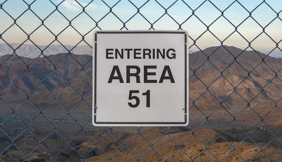
spinner image Entering Area 51 sign on a fence at The Military Base in Nevada desert at sunset
Mr Doomits / Alamy Stock Photo

Day 1: Las Vegas to Rachel (150 miles)

Begin your adventure with a long drive on the peaceful but largely deserted Great Basin Highway (U.S. Highway 93), where, for 100 miles, you'll find little civilization but cacti, Joshua trees and yuccas as far as the eye can see. Still, it's what you won't see when you soon travel the E.T. Highway (E.T.H.) that makes the day so alluring. The notorious highway runs along the north side of the Nellis Air Force Range, home to Area 51, a top-secret government facility and magnet for conspiracy theories — stories bolstered by frequent reports of UFO sightings and alien activity.

You know you're getting close to the E.T.H. when the scenery transforms from light tans and browns to bright greens and blues near the lush wetlands and grasslands of Pahranagat National Wildlife Refuge in Alamo. Do check out the refuge, a major pit stop in spring and fall for more than 230 migratory bird species and a year-round home to species including American coots and great blue herons. You may also spot black-tailed jackrabbits, desert tortoises, monarch butterflies, mule deer and northern leopard frogs while walking or biking on the refuge's seven miles of trails or angling for carp and green sunfish in its Upper Lake or North Marsh. Historical petroglyphs and pictographs reveal Pahrangat's ties to the Paiute tribe. You'll find picnic spots and bathrooms here.

Gas up in Alamo or nearby Ash Springs, then continue north from the latter for another five miles on U.S. 93 to the Y-shaped junction of the E.T.H. and State Route 318. But don't hop onto the alien byway just yet. At the junction sits E.T. Fresh Jerky, a quirky snack and novelty shop with bathrooms. Outside, snap selfies in front of elaborate alien murals. Inside, browse an array of fresh jerky, dried fruit, nuts and E.T.-themed souvenirs such as gooey space slime, inflatable aliens and little green plushies.

At the start of the E.T.H., park under the towering cottonwood trees and snap a photo with the Extraterrestrial Highway sign, marking the road's official entrance. On the road, you'll immediately see a state historical marker to the south, followed by a statue of a tall silver alien to the north. The shiny, elongated space invader guards the entrance to the Alien Research Center, another gift shop where you can bone up on UFO and military trivia, trade abduction stories, buy books on paranormal subjects, and pick up an alien head-shaped bottle of handcrafted Alien Tequila, a liquor brand created by the store's owner, George Harris. Behind the store, you'll see photo-friendly replicas of the military-installation warning signs posted at the back gate to Area 51 to prevent trespassing. Inquire inside for directions to the real, heavily guarded back gate, located more than 40 miles away near tonight's destination, Rachel.

The E.T.H., which attracts astronomy buffs, geocachers and photographers, offers a picturesque drive through mostly untouched wilderness. You probably won't encounter another soul, other than the occasional cow. From the Alien Research Center, drive through open range for 18 miles to the Black Mailbox, a receptacle for letters to another galaxy on the highway's south side, at Mail Box Road. This meeting spot for aliens enthusiasts makes for a cool photo op.

Drive another 20 miles through desert (and deserted) curves, ridges and valleys. Just when you think you'll never see civilization again, the tiny town of Rachel (population 54) appears like a distant mirage. Known as the “UFO Capital of the World,” Rachel is a former mining town with few permanent structures and businesses. In fact, the town recently opened its first gas station in more than a decade, the Alien Cowpoke Gasoline and Convenience Store. Next door, the Little A'Le'Inn has provided earthlings with lodging, RV and camping space, food and drink for 25 years. Its dining room includes a pool table, a gift shop, tables and bar seating. You'll want to take advantage of the interesting photo ops inside and out, which include alien figurines, murals and a pickup with a flying saucer in tow. Especially quirky: a “self-parking” sign for UFOs. You're also likely to run into at least a couple of locals willing to share the mysterious reasons they moved to Rachel.

Where to stay: Be prepared to see more than bright stars in the sky tonight after settling into one of five modular trailer units at the Little A'Le'Inn. No guarantee, but strange sightings do happen. Each bare-bones unit includes two or three motel-style rooms with a shared bathroom, so you'll have to book a full unit if you want a private commode. While there isn't much to do in Rachel other than chat with locals and other visitors, the inn has VCR tapes you can borrow and watch in your room. Rooms from $60.

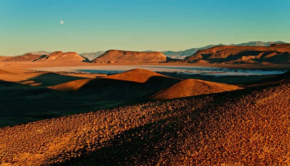
spinner image Aerial shot of Lunar Crater National Natural Landmark, a volcanic field in Nye County, Nevada, at sunset.
Lunar Crater National Landmark
halbergman / Getty Images

Day 2: Rachel to Tonopah (110 miles)

Yesterday you learned about the semi-hidden back gate to Area 51. Today, after taking in a colorful Nevada sunrise and filling up on a hearty breakfast at the Little A'Le'Inn, venture down the long, dirt track to the gate, about an eight-mile drive from Rachel. Yes, it's OK to approach the gate (most people even take photos), but don't trespass or try any funny business or your road trip could result in a jail stay.

Now head west toward Tonopah on the E.T.H. After 59 desolate but tranquil miles of desert, ridges, mountain wilderness, cows and marshes, you'll reach the abandoned town of Warm Springs. Here, take a 34-mile detour northeast on U.S. Highway 6 to the Lunar Crater Backcountry Byway, an unpaved scenic loop that passes the Lunar Crater National Landmark. Located in a volcanic field, the 430-foot-deep crater, formed 6 million years ago by lava and water, so closely resembles the moon's landscape that Apollo astronauts used it as a training ground in the 1970s. While vehicles must stay on roads and trails, you can explore the crater, lava beds and surrounding extinct volcanoes on foot.

Head back southwest on Route 6 for 84 miles to Tonopah. You'll come to a comfortable rest stop with bathrooms about 25 miles from Tonopah, but there are no other facilities until you reach the town.

Formerly a mining boomtown, Tonopah (population 2,009) has undergone a makeover in recent years with the addition of planters, benches and public art throughout town, as well as a number of new shops and businesses. From square-toed boots to 10-gallon hats, you can channel your inner cowboy at A Bar L Western Store, or you can ogle silver and turquoise jewelry at the Tonopah Trading Company, both on the quaint, western-style Main Street. The historic street is also home to the five-story, landmark Mizpah Hotel, with its vintage rooftop marquee sign. Once Nevada's tallest building, the hotel opened in 1907 and was restored in 2011. It's said to be haunted by mischievous but friendly ghosts from the mining era who move objects and flip light switches.

Speaking of haunted hotels, you may have seen your next stop on the Travel Channel's Ghost Adventures — the world-famous, multicolored and recently renovated Clown Motel, located a half mile north of the Mizpah on Main Street. Visitors typically snap photos out front, then wander inside to eye the more than 2,000 clown figurines and dolls in the lobby. A stroll through the surprisingly charming Old Tonopah Cemetery next door provides a glimpse into the lives and deaths of some of the town's earliest residents. You can also learn more about Tonopah's history at the Central Nevada Museum on Logan Field Road.

Come dinnertime, sit down for a feast of slow-cooked BBQ and home-brewed beer on the patio at Tonopah Brewing Company on Main Street, three blocks south of the Mizpah. Finish your day soaking up an amazing view of the star-filled nighttime sky at Stargazing Park a bit farther south, at the end of Ray Tennant Drive, an unpaved road east of Main Street.

Where to stay: Share your accommodations with the ghost of the Lady in Red at the 47-room Mizpah (rooms from $116) or bed down chuckling at the custom-painted clown art in your room at the 31-room Clown Motel (from $75).

spinner image Tribute to Shorty Harris sculpture at Goldwell Open Air Museum
Goldwell Open Air Museum
Ken Howard / Alamy Stock Photo

Day 3: Tonopah to Beatty (94 miles)

Pop into the Mizpah's Pittman Café for the Pittman Breakfast (two eggs with your choice of ham, bacon or sausage, hash browns or home fries, and toast) before spending the morning exploring the Tonopah Historic Mining Park, behind the Mizpah on Burro Avenue. Wander through more than 100 acres, where you'll see mine shafts, restored equipment, historic exhibits and a blacklight mineral display. You can also stand over a 500-foot gap in the earth in a steel viewing cage.

After a specialty sandwich and some great photo ops at the Tonopah Station Hotel, Casino, Restaurant and RV Park, head south on U.S. 95 for 27 miles. You'll hit Goldfield (population 298), a prosperous boomtown in the early 1900s and even home, for a short time, to Wyatt and Virgil Earp. In less than two decades, this boomtown went bust, followed by a fire and a flash flood. Only a handful of the original buildings remain, including the courthouse, the jail, the Goldfield Hotel and the Santa Fe Saloon (which is still open if you feel like grabbing a drink). In addition to the town's photo-worthy buildings, the Pioneer Cemetery and its 1908 grave for a hungry drifter who died in Goldfield after eating library paste is worth a snapshot and a laugh.

At the edge of Goldfield, follow the signs pointing east to the International Car Forest of the Last Church, located a mile off Route 95. The creation of two artists, Chad Sorg and Mark Rippie, the scattered landscape of junked and masterfully graffitied cars and trucks, even a bus, rises from the sand like a deconstructed Stonehenge stretching toward the mountains.

Back on 95, a 30-minute detour at State Route 266 to State Route 774 lands you in the former silver mining town of Gold Point, now a well-preserved ghost town with a standing Main Street, a saloon and the operating Gold Point Bed and Breakfast. Much of the town has been restored, providing yet another fascinating glimpse into Nevada's Wild West past.

Next head about an hour south on 95 to Beatty (population 1,015). Since Beatty is the gateway to Death Valley National Park, you're on the right track if you plan to visit the park. You may see a stray burro or two as you drive down Beatty's Main Street to State Highway 374 South. In about six miles, you'll come to Rhyolite Ghost Town, a once-prosperous gold mining boomtown with saloons, gambling, lodging, restaurants and even a weekly newspaper. A house built from 50,000 bottles, a cemetery and a well-preserved train depot are among today's sights. Rhyolite's centerpiece, the Goldwell Open Air Museum, cropped up in 1984 with a ghostly, life-sized rendition of The Last Supper by Belgian artist Albert Szukalski. The 15-acre outdoor sculpture garden now blooms year-round with a visitors center, an artist residency program and several large-scale contemporary art pieces.

On your way back from Rhyolite, stop at the Beatty Museum on Main Street to learn more about pioneer life in the Bullfrog Mining District. For dinner, try the carne asada tacos from the food truck behind Gema's Café on 2nd Street or grab a cold beer and a bowl of chili at Happy Burro on Main Street.

Where to stay: You can see native and non-native cacti, grasses, flowers and trees in the water-friendly, xeriscaped garden at the retro-style and recently remodeled 45-room Atomic Inn on South First Street. Rooms from $60.

spinner image Ash Meadows National Wildlife Refuge, Nevada
Ash Meadows Wildlife Refuge
George Ostertag / Alamy Stock Photo

Day 4: Beatty to Las Vegas (136 miles)

Get coffee, breakfast pastries, gas and any last-minute souvenirs or snacks at the Death Valley Nut & Candy Co. in Beatty before driving 30 miles southeast on 95 to State Route 373 South, then another 18 miles to the Ash Meadows Wildlife Refuge. Here, on 24,000 acres of wetlands and desert uplands, you'll find nearly 30 species of endemic plants and animals (found only here), including the only naturally occurring population of the endangered pupfish, in the mysterious and seemingly bottomless water-filled Devils Hole cavern. Though the flowers bloom year-round, every season brings unique viewing experiences. In the fall, the ash trees turn orange and gold, and wildlife, including bighorn sheep, lizards and numerous bird species, abounds. Steam rising from the refuge's warm waters can make winter mornings seem mystical.

Drive 35 miles southeast on Bell Vista Road to Pahrump and raise a glass to your Wild West road trip with a wine tasting at the Pahrump Valley Winery and lunch or dinner on-site at the upscale yet laidback Symphony's Restaurant, overlooking a beautiful vineyard. After your meal, make your way back to Las Vegas, 60 miles east on State Route 160.

AARP Travel Center

Or Call: 1-800-675-4318

Enter a valid departing date

Enter a valid returning date

Age of children:

Child under 2 must either sit in laps or in seats:

Enter a valid departing date

Age of children:

Child under 2 must either sit in laps or in seats:

Enter a valid departing date

Age of children:

Child under 2 must either sit in laps or in seats:

Flight 2

Enter a valid departing date

Flight 3

Enter a valid departing date

Flight 4

Enter a valid departing date

Flight 5

Enter a valid departing date

+ Add Another Flight

Enter a valid checking in date

Enter a valid checking out date


Occupants of Room 1:


Occupants of Room 2:


Occupants of Room 3:


Occupants of Room 4:


Occupants of Room 5:


Occupants of Room 6:


Occupants of Room 7:


Occupants of Room 8:


Enter a valid departing date

Enter a valid returning date

Age of children:

Occupants of Room 1:

Age of children:


Occupants of Room 2:

Age of children:


Occupants of Room 3:

Age of children:


Occupants of Room 4:

Age of children:


Occupants of Room 5:

Age of children:

Age of children:

Child under 2 must either sit in laps or in seats:

Enter a valid start date

Please select a Pick Up Time from the list

Enter a valid drop off date

Please select Drop Off Time from the list

Select a valid to location

Select a month

Enter a valid from date

Enter a valid to date