AARP Hearing Center
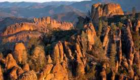
Nowhere are the shape-shifting powers of water, wind and rock more dramatically on display than in Canyonlands National Park (CNP) in southeast Utah. This immense expanse of the Colorado Plateau has been etched by the Green and Colorado rivers into a relief panel of chiseled buttes, twisted rock spires and deeply incised canyons.
Here, millions of years of geologic upheaval, compression and erosion have left behind a magical landscape where you can peek into caves; wander between rock formations resembling castles, towers and fantastical creatures; and slip through canyons narrow enough to touch both sides.
Human history also comes alive in CNP, with archaeological evidence of human habitation dating back more than 10,000 years. Native tribes, pueblos and communities are associated with the land, in a region that served as hunting grounds for early hunter-gatherers and then home to the Ancestral Puebloan people. This heritage is still apparent in the park, with ancient cliff dwellings, petroglyphs and pictographs, and trails that have been traveled for centuries.
Canyonlands was established as a national park in 1964. It owes much of its more recent history to the role of mining in this part of the American West.


Fact Box
Location: Southeast Utah
Acreage: 337,598 acres
Highest point: 7,180 feet (above Big Pocket in the Needles District)
Lowest point: 3,900 feet (on the Colorado River)
Main attraction: Stunning canyon views and unusual rock formations
Entry fee: $30
Best way to see it: By car
When to go: April through early June and late August through October, for more temperate weather
But uranium, not gold or silver, lured fortune-seekers to this isolated and intimidating region — the chemical element was in high demand during the 1950s and early ’60s. Ultimately, however, little uranium was mined here, although the 1,000 miles of roads funded by the Atomic Energy Commission opened up the inner canyons to exploration and convinced locals that this geological wonderland deserved protection and preservation.
The largest of Utah’s five red rock national parks at 337,598 acres, CNP is essentially three parks in one, separated by the Green and Colorado rivers, which come together in a confluence near the center of the park.
No roads connect the sections of the park (each has its own entrance), and no bridges span the rivers.
Depending on your time and how much you want to explore on foot or driving, you may do as most visitors do and limit your experience to just two sections: Island in the Sky, a high mesa that comprises the park’s northern end, and The Needles on the park’s southeast side, named for its impossibly spindly rock spires.
The third area, the rugged and remote labyrinth of canyons on the park’s southwestern side deservedly called The Maze, requires four-wheel-drive to go beyond the ranger station and is a favorite among advanced hikers (steep and unmarked trails) and backcountry campers.
Within the park boundaries, the Colorado River shoots through the sheer-sided chasm of Cataract Canyon, creating Class V rapids. While Big Drops and Satan’s Gut challenge even the most experienced rafters, quieter stretches provide plenty of fun for families and novice rafters.
Plan your trip
The closest major airport to CNP is Grand Junction Regional Airport, 122 miles northeast, while the closest national hub is Salt Lake City, 247 miles northwest. Tiny Canyonlands Regional Airport in Moab, the closest big town to the park, is served by SkyWest Airlines in partnership with Delta Air Lines and United Airlines.
Sitting atop a mesa more than 1,000 feet above the surrounding lands, the Island in the Sky district is one of the most popular of CNP’s sections. There, a scenic drive zigzags around the rim, providing one dramatic canyon view after another. When arriving from Moab in the north, many visitors start at the Island in the Sky Visitor Center just inside the park. There you can see fauna, flora and geology exhibits; watch an introductory video to the park; and check out the schedule of ranger programming.
The Needles, named for its layers of spiky sandstone striped in gold and ocher, has its own visitor center inside the entrance to this section, about 74 miles southeast of Moab. The Maze, on the park’s western side, is served by the Hans Flat Ranger Station, where you’ll find a small selection of books and maps, a vault toilet and a picnic table. There are no paved roads there, although the unpaved path to the station is navigable with two-wheel drive; its other roads require a four-wheel-drive, high-clearance vehicle.


