AARP Hearing Center
Following is an AARP summary of the walking action plan developed by Janet Castaños, a State Walking College Fellow, for the southwestern part of the city.


PLAN VISION AND GOALS
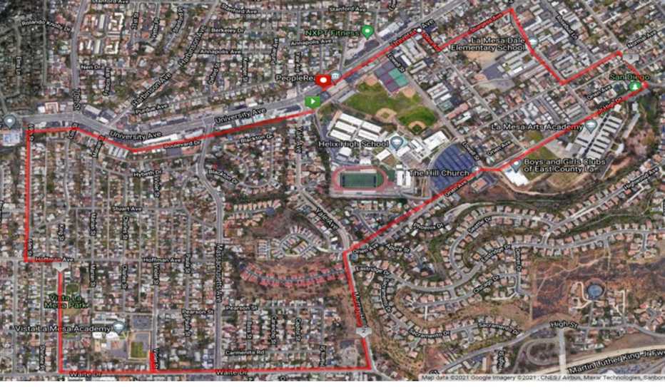
Built along an undeveloped corridor in the western part of the city, the four-mile West La Mesa Urban Trail will link four schools, two parks and three community centers as well as numerous restaurants and businesses.
The goal is to enhance the health of community members, encourage active transportation, and improve the vibrancy of the neighborhoods. Reducing the number of cars on the road will positively impact La Mesa’s Climate Action Plan and the La Mesa Age-Friendly Action Plan.
Janet Castaños
State Walking College Fellow
Class of 2021

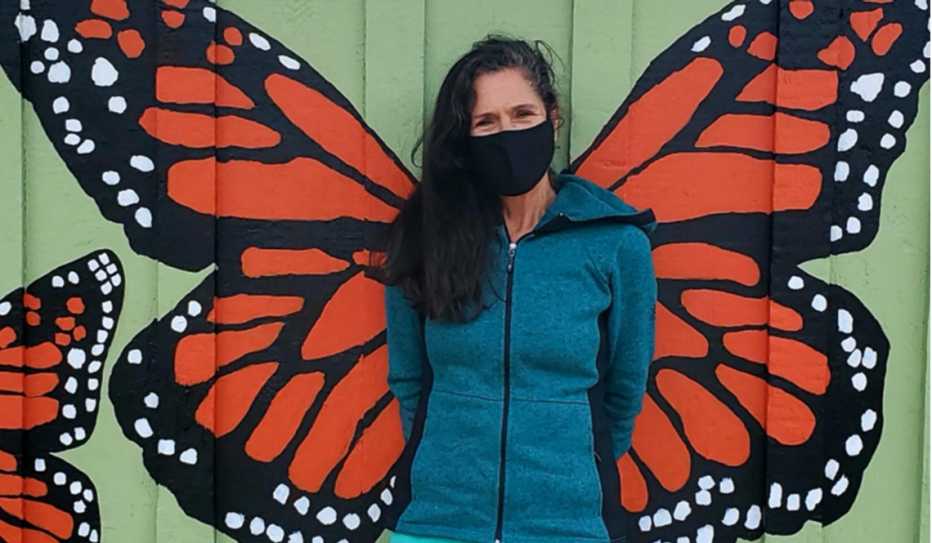
Janet Castaños, Ph.D., is an educator and the chair of the La Mesa Community Police Oversight Board, which is tasked with reviewing police conduct and improving the community’s relationship with law enforcement. She has lived in La Mesa for more than three decades and volunteers for the nonprofit organizations Envision La Mesa and La Mesa Conversations.
THE LOCATION
La Mesa is located northeast of San Diego, California, and has a population of about 60,000 residents.
Civil unrest following the 2020 murder of George Floyd by a Minneapolis police officer resulted in significant damage to the city’s center. Much of the rebuilding efforts have been focused on that area with less attention given to the working class neighborhoods of southwest La Mesa.
Parents in the southwestern part of the city typically drive their children to school or community centers rather than allowing them to walk. This is due in part to unsafe walking conditions along the fast-moving Hoffman Drive, where there are few sidewalks, shaded areas or marked crosswalks. Traffic is also heavy on nearby traffic corridors (University and Massachusetts avenues) and speeding is often a problem.
The neighborhood has a water channel, called the University Channel, that often fills with debris, invasive plants and toxins that eventually end up in Chollas Lake. The channel, which runs along the northern portion of the proposed path, could enhance the natural beauty of the area if cleaned up and restored.

POTENTIAL COMMUNITY PARTNERS
- Envision La Mesa and La Mesa Conversations
- City of La Mesa (Community Services Department, Public Works Department )
- La Mesa Police Department
- Helix Charter High School
- La Mesa Spring Valley School District
- Lemon Grove School District
- Boys and Girls Club and Teen Center
- Vista La Mesa Church
- Kroc Center
- San Diego Municipal Transit Services
THE PLAN
- Complete one or more walk audits of the built environment. [Scroll down to find a free walk audit tool kit from AARP.]
- Create a designated walking route along University Channel that connects to the Emerald La Mesa Urban Trail between the schools, parks and community centers
- Create a designated walking route along Hoffman Drive from 69th Street to a lighted crossing at Massachusetts Avenue
- Work with the city’s Community Services Department, engineers and planners to create a parklet on 69th and Boulevard Drive as well as on the corner of Boulevard and Massachusetts Avenue
- Work with businesses along University Avenue to clean up the back of their buildings on Boulevard
- Provide space for community art and bench areas with shade trees
- Facilitate agreements for adding a mural along a location that runs parallel to the trail
The Problem List
During a walk audit of the proposed trail location, community members identified a number of concerns:
- storm drain flooding
- disconnected sidewalks
- a lack of speed limit signs
- garbage, dumping and graffiti
- inaccessible crosswalks
- unsafe intersections
- minimal trees and vegetation
- no lighting
- invasive plants
- a dangerous gutter drain
- parked cars blocking sidewalks
- inadequate wheelchair access
- the need for fencing
POTENTIAL CHALLENGES
- The city lacks funding to address all the proposed needs
- Improving walking paths is a city-wide concern that isn’t isolated to west La Mesa
- The land along the creek is owned by multiple homeowners and businesses
- The street and sidewalk area along 69th Street is owned by the City of San Diego, not the City of La Mesa
- Apartment renters along the route may not be long-term residents and might not be willing to participate in the advocacy effort
EVALUATING SUCCESS
- Route completion
- Positive assessments based on walk audits
- Park and parklet installations
- The amount of community art designed and displayed
- A reduction in auto, pedestrian and bicyclist collisions
WHAT’S BEEN ACCOMPLISHED SO FAR
As of February 2022:
The proposed West La Mesa Urban Trail (also referred to as the Secret Creek Walking Path) was presented to the La Mesa Mobility Commission at its January meeting. The commission responded positively to the proposed plan and encouraged Envision La Mesa to seek grant funding sources for portions of the trail.
Since the proposed trail is about four miles in length with many component parts, it was also recommended that the Envision La Mesa focus on one portion at a time. The community group plans to focus on the area adjacent to the University Channel.
A few weeks later, the La Mesa city staff requested approval from the city council to submit a grant proposal through the SANDAG Clean California Local Grant Program. The request was approved by the La Mesa City Council. The city staff and the Envision La Mesa community group are writing a grant proposal for adding a parklet near the open channel area that has been the site of flooding, dumping, graffiti and invasive plant growth.
On January 31, a meeting was held with a muralist to review the plan for a painting along the path adjacent to the channel. The mural design and painting is scheduled to begin in the spring.
Page published March 2022

