AARP Hearing Center
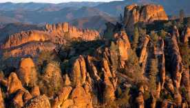
Pinnacles National Park checks all the boxes for nature lovers. Thirty miles of hiking trails from gentle creek-side strolls to stiff cliff-hanging switchbacks. Giant monoliths. Rust-colored rock cloaked in a kaleidoscope of lichen.


Facts
Park location: East of Central California’s Salinas Valley
Acres: 26,674
Highest peak: North Chalone Peak, at 3,304 feet above sea level
Lowest valley: South Chalone Creek, at 824 feet above sea level
Miles of trails: 30-plus miles
Main attraction: Balconies and Bear Gulch Caves
Cost: $30 per-vehicle entrance fee, valid for seven straight days; $25 for motorcycles; $15 for bicycles or walk-in entry; $55 for Pinnacles annual passes
Best way to see: On foot by hiking one of its 15 trails
When to go to: Mid-February through mid-May for mild weather and splashy wildflowers
There’s beauty everywhere you look. About 100 varieties of wildflowers bloom throughout the year, and more than 180 bird species, including North America’s largest bird, the critically endangered California condor and its majestic roughly 10-foot wingspan, can be spotted in the park. A concerto of calling quails, gobbling turkeys, drumming woodpeckers and whistling hummingbirds are also present.
Don’t let Pinnacles National Park’s (PNP) status as California’s smallest and least-visited national park fool you. This mesmerizing volcanic wilderness on the southern edge of central California’s Gabilan Mountain Range is a hot spot for ecological diversity and outdoor recreation. It is blanketed by a vast network of chaparral forests, pine and oak woodlands, golden grasslands and 3,000-foot peaks. The park is where Chalon, Mutsun and other Native Americans lived and used bedrock mortars to grind acorns and pine nuts for millennia.
Long overshadowed by its ever-popular park brethren — Yosemite, Death Valley, and Joshua Tree top the in-state visitor list — Pinnacles holds a unique title of its own: California’s youngest national park. When President Barack Obama promoted the 26,674-acre wonderland in 2013, PNP became America’s 59th national park and the Golden State’s ninth such accreditation, the most of any state. The designation shed the park’s longstanding national monument rank assigned by President Theodore Roosevelt more than a century ago.
A prime illustration of tectonic plate movement, PNP formed about 23 million years ago after numerous eruptions of the Neenach volcanic field near present-day Lancaster, California, 195 miles southeast of the park. In cooperation with the San Andreas Fault, the park traveled north to its current address over millions of years, where wind and water erosion have since shaped its eye-popping matrix of rock-strewn terrain. To this day, scientists estimate that Pinnacles is migrating northwest at a rate of 1.5 to 2 inches per year — or, the same speed that our fingernails grow.
In a state teeming with natural beauty and park options, Pinnacles’ 41 square miles of spellbinding topography flies under the radar and can be explored relatively crowd-free most of the year, especially on weekdays. In 2022, there were 275,023 visitors in the park, an uptick from its historical average of 150,000 to 200,000 people. Still, last year’s figure marked the eighth-lowest head count for national parks in the Lower 48.
For park ranger Richard Moorer, “condors and caves” is what sets Pinnacles apart from the rest of the national park system.
“The California condor, one of the rarest birds in the world, is often seen soaring over Pinnacles,” Moorer says. “And there are two talus caves that are unusual as they are technically above ground.” Moorer’s sagest advice when visiting this moving mountain: “Just find a sunny spot to take in the wonder around you.”
Plan your trip
Just east of the Salinas Valley, Pinnacles’ low-key status stems from its semisecluded location in central California. The park has two entrances — the east and west — with no connecting road between the two. To get from one side to the other, you must exit and drive around the park, which takes about an hour and a half.
To access the west entrance, take Highway 101 either south from San Francisco or north from Los Angeles to Soledad. From there, you’ll take Highway 146 east to the gate. To access the east entrance, travel Highway 101 south to Highway 25 south. If traveling from the north, you’ll access Highway 25 through Hollister; if traveling from the south, you’ll connect to Highway 25 near King City.
By air, depending on your departure city, consider flying into Monterey Regional Airport, about an hour closer to Pinnacles’ west entrance than San Francisco International Airport. The pint-size airport offers nonstop flights from nine U.S. cities, including major hubs such as Dallas, Denver and Phoenix.
A great time to visit PNP is between mid-February and early June, when the weather is moderate, and the wildflowers are showy. Visitation numbers tend to peak at this time, especially on weekends. For solitude, arrive early on a weekday and you’ll have no problem with crowds or parking. As an alternative, Moorer recommends a fall visit.


